
US State Dept. Map Error at Global AIDS Conference
A State Department slide mislabeled African nations at a major health summit in Rio, prompting a departmental apology.
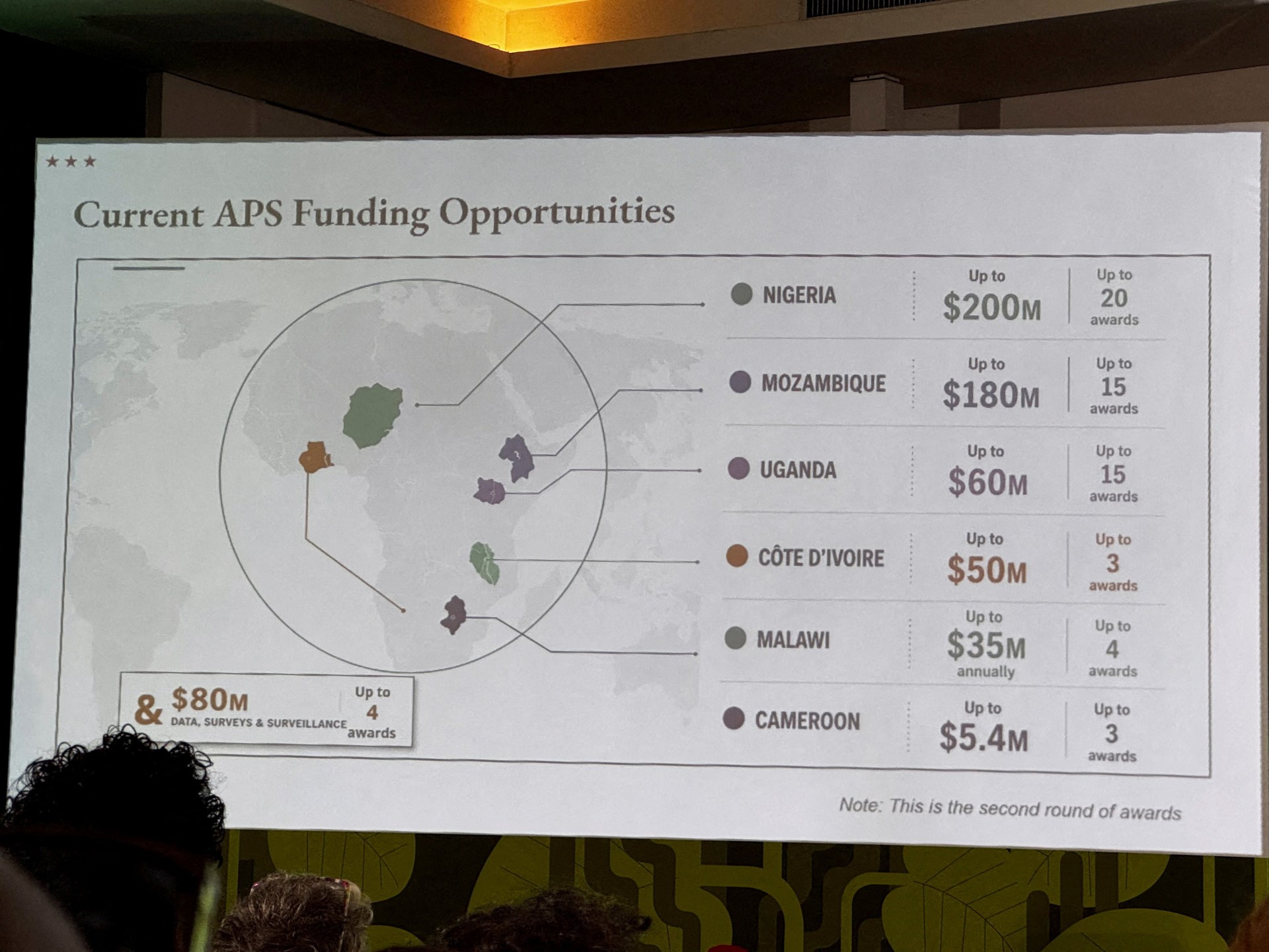
The update
US officials attending the AIDS 2026 conference in Rio de Janeiro used a map with significant geographic inaccuracies during a presentation on health agreements with African nations. The errors—highlighted by attendees who posted videos and screenshots online—showed Nigeria placed in the Sahara Desert and Mozambique positioned in the eastern Horn of Africa. The map also placed Ivory Coast on the opposite side of the continent and depicted country boundaries as indistinct shapes.
Why it matters
The error occurred during a presentation by a top health envoy at a critical moment for US-Africa relations. The presentation followed recent changes in US aid policy, making the geographic mistakes a potential diplomatic liability. The incident raises questions about the vetting process for materials used in high-level diplomatic engagements.
What to watch
Observers will watch for any formal responses from African governments and whether the State Department will revise its internal protocols for slide creation. The source of the map, which appears to contain AI-generated watermarks, may also become a point of scrutiny.
Sources
- aljazeera.com — Specific country errors (Nigeria, Mozambique, Ivory Coast), attendee reaction, AI watermark details, and State Department apology.
- nytimes.com — Confirmation of the 'hastily altered' description and the nature of the errors.
How did this story land?
Choose one reaction. Choosing it again leaves it selected.